 |
Kohls-Ranch
is a small community and also the name of a mountain resort located on the banks of Tonto Creek in central Arizona. It's surrounded by the largest Ponderosa Pine forest in the world, near the town of Payson. There is also a small, unincorporated community in the area with the name of Kohls Ranch. Since 1924, visitors have been coming here for the lovely scenery, clean mountain air and peaceful surroundings. Famous author, Zane Grey, wrote many of his westerns at this site. Adjacent to the community of Kohls Ranch is Camp Tontozona, which is the training camp for the Arizona State University football team. There are also 3 national forests near Kohls Ranch; the Coconino and Sitgreaves are at the higher elevation and the Tonto National Forest is at the lower region. Another amazing attraction is Tonto Natural Bridge State Park, which includes the world's largest natural travertine bridge that rises 183 feet above Pine Creek. Among the many activities at Kohls Ranch are golf, hiking, fishing, horseback riding, kayaking, rafting and cross country skiing. The Shoofly Village Ruins, near Kohls Ranch, contain two-story dwellings that date to between AD 850 and 1260. The nearby town of Payson is home to the "World's Oldest Continuous Rodeo, which is considered by the Professional Rodeo Cowboys Association as the country's best small rodeo. Other special events in the area include the State Championship Old Time Fiddlers' Contest and Bluegrass Festival.
Surrounding areas: Payson, Arizona (14.7 mi), Forest Lakes, Arizona (16.8 mi), Young, Arizona (17.2 mi), Pine, Arizona (21.0 mi), Strawberry, Arizona (23.5 mi), Heber, Arizona (29.2 mi), Overgaard, Arizona (30.8 mi)
|

|
Kohls Ranch Vacation Rentals
|

|
|
|

|
Kohls Ranch Hotels and Resorts
|

|
|
| | | Hotels & Motels |
| Best Western Payson Inn | 801 N Beeline Hwy | Payson, AZ | 14.0 mi. | (928) 474-3241 | | Holiday Inn Express | 206 S Beeline Hwy | Payson, AZ | 14.4 mi. | (928) 472-7484 | | Days Inn & Suites Payson | 301-A South Beeline Hwy | Payson, AZ | 14.7 mi. | (928) 474-9800 | | Majestic Mountain Inn | 602 E Hwy 260 | Payson, AZ | 14.7 mi. | (928) 474-0185 | | Super 8 Motel | 809 E Hwy 260 | Payson, AZ | 14.7 mi. | (928) 474-5241 | | Payson Travelodge | 101 W Phoenix St | Payson, AZ | 15.1 mi. | (928) 474-4526 | | Forest Lakes Lodge | | Forest Lakes, AZ | 15.5 mi. | (602) 535-4727 | | Pleasant Valley Inn | Hwy 288 & Midway Ave | Young, AZ | 17.2 mi. | (928) 462-3593 | | Best Western Sawmill Inn | 1877 Hwy 260 | Heber, AZ | 29.5 mi. | (928) 535-5053 |

|
Kohls Ranch Weather & Climate
|

|
|
|
East-central Arizona has a semi-arid climate with hot summers and mild winters. The climate is somewhat tempered by the elevation in the area, making it slightly cooler than the Phoenix and Yuma desert regions. Nonetheless, summers are hot; daytime highs are generally between 90 and 100 degrees F. In July and August, it's not uncommon to see temperatures soar above 100 degrees F. In winter, east-central Arizona sees daytime highs between 55 and 65 degrees F. and nighttime lows at, or just above, freezing. Rainfall is possible anytime of the year, but most common during the Monsoon of July and August. Snowfall is rare in this part of Arizona. Snow of an accumulation of 0.1 inches or greater has occurred in central Arizona only eight times since 1898.
|
| Month |
High Temp |
Low Temp |
Rainfall |
Ocean Temp |
| January |
54°F |
25°F |
3.98 in. |
- |
| February |
58°F |
27°F |
3.41 in. |
- |
| March |
63°F |
30°F |
4.31 in. |
- |
| April |
71°F |
34°F |
1.57 in. |
- |
| May |
79°F |
41°F |
1.05 in. |
- |
| June |
90°F |
49°F |
0.35 in. |
- |
| July |
92°F |
57°F |
3.69 in. |
- |
| August |
90°F |
57°F |
4.46 in. |
- |
| September |
85°F |
50°F |
2.53 in. |
- |
| October |
75°F |
40°F |
2.40 in. |
- |
| November |
62°F |
30°F |
2.60 in. |
- |
| December |
54°F |
25°F |
2.68 in. |
- |

|
Kohls Ranch Map & Transportation
|

|
|
 |
|
|
| Click each thumbnail image to enlarge. |
 |
 |
 |
 |
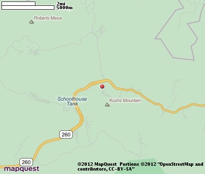
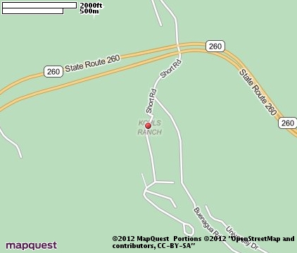
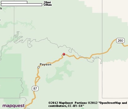
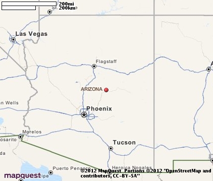
The closest airports in the area are the Winslow Lindbergh Regional airport (INW) located about 52 miles northeast of Kohls Ranch in Winslow, Arizona, the Taylor airport (TYL) located approximately 56 miles east of Kohls Ranch in Taylor, Arizona, the Show Low Regional airport (SOW) located roughly 62 miles east of Kohls Ranch in Show Low, Arizona, the Scottsdale airport (SDL) located around 67 miles southwest of Kohls Ranch in Scottsdale, Arizona, the Phoenix Deer Valley airport (DVT) located about 71 miles southwest of Kohls Ranch in Phoenix, Arizona, and finally the San Carlos airport (4AZ7) located approximately 74 miles south of Kohls Ranch in San Carlos, Arizona.
|

|
Kohls Ranch Attractions
|

|
|
| | | Amusement and Theme Parks |
| Castles n' Coasters | Phoenix | AZ | 79.7 mi. | | | Enchanted Island | Phoenix | AZ | 79.7 mi. | | | Schnepf Farms | Queen Creek | AZ | 80.9 mi. | |
Notice a problem with the information on this page? Please notify us.
|
Disclaimer: We recommend you conduct your own research regarding all accomodations and attractions found on this website. The distances shown on this website are straight-line distances as the crow flies. The road distance may be considerably longer. You assume all liability for use of any information found on this website. No information is confirmed or warranted in any way. By using our services you agree to the terms and conditions of this disclaimer.
|
| We are the #1 site for your Arizona Vacation presenting Arizona vacation rentals, hotels, weather and map for each city. |
Arizona Vacation .org
©1997-2025 All Rights Reserved.
|
|