 |
Overgaard
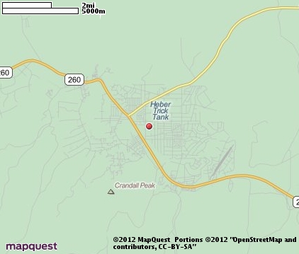
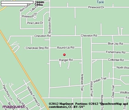
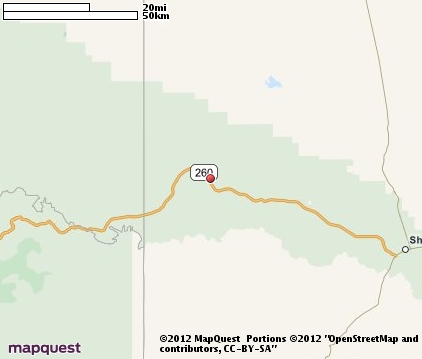
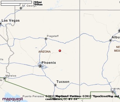
is situated in Navajo County in the Sitgreaves National Forest, north of the Mogollon Rim and northeast of Phoenix. Often mentioned along with its sister community, Herber, the two mountain towns are reached by taking State Highway 87 to Payson (north from Phoenix or south from I-40) and continuing east on State Highway 260. Both communities are unincorporated and were settled during the Mormon migration in the late 1800s. The elevation of Overgaard is 6,620 feet and the elevation of Herber is 6,435 feet. Economic opportunities in the area are varied, with retirement and tourism playing an important role in the local economy. The Overgaard area is surrounded by lots of year round outdoor recreational opportunities and scenic points of interest, including the Sitgreaves National Forest. Just south of town is the Mongollon Rim, a steep escarpment that ranges from 1,000 to 2,000 feet at the highest plateau. The Rim divides the northern plateau region from the lower central and southern regions and offers many scenic vistas and numerous man-made lakes, ideal for boating and other water sports. Fishing for trout, picnicking, camping and hiking are other popular activities in the Overgaard area. Scenic points of interest include the Chevelon Canyon Dam, the Canyon Creek Fish Hatchery, Chevelon Butte and the Fort Apache Indian Reservation.
Surrounding areas: Heber, Arizona (2.6 mi), Forest Lakes, Arizona (14.4 mi), Pinedale, Arizona (19.3 mi), Kohls Ranch, Arizona (30.8 mi), Young, Arizona (31.4 mi), Show Low, Arizona (32.4 mi), Lakeside, Arizona (38.2 mi)
|

|
Overgaard Vacation Rentals
|

|
|
|

|
Overgaard Hotels and Resorts
|

|
|
| | | Hotels & Motels |
| Best Western Sawmill Inn | 1877 Hwy 260 | Heber, AZ | 2.1 mi. | (928) 535-5053 | | Forest Lakes Lodge | | Forest Lakes, AZ | 15.5 mi. | (602) 535-4727 | | Comfort Inn-snowflake | 2055 S Main St | Snowflake, AZ | 27.8 mi. | (928) 536-3888 |

|
Overgaard Weather & Climate
|

|
|
|
North-central Arizona has a temperate high desert climate. A combination of high elevation and low humidity produces mild weather conditions most of the year. The average temperature in this region runs 28 degrees F. cooler than the lower desert regions. Summer temperatures are usually in the 90s, but may sometimes reach 100 degrees. Annual precipitation is just over 19 inches. Most rain occurs during the monsoon of July and August. Brief, but intense, afternoon thunderstorms are also a possibility. Winter brings cooler temperatures and an occasional dusting of snow. Elevation in northern Arizona which ranges from 2,600 feet to over 12,000 feet. Much more snow is received in the higher elevations, but even so, the relatively low latitude and plentiful sunshine quickly melts the snow.
|
| Month |
High Temp |
Low Temp |
Rainfall |
Ocean Temp |
| January |
47°F |
18°F |
1.50 in. |
- |
| February |
50°F |
20°F |
1.55 in. |
- |
| March |
55°F |
25°F |
1.70 in. |
- |
| April |
63°F |
29°F |
0.60 in. |
- |
| May |
71°F |
36°F |
0.74 in. |
- |
| June |
82°F |
44°F |
0.48 in. |
- |
| July |
83°F |
52°F |
2.70 in. |
- |
| August |
81°F |
51°F |
3.23 in. |
- |
| September |
76°F |
44°F |
2.01 in. |
- |
| October |
66°F |
33°F |
1.64 in. |
- |
| November |
54°F |
23°F |
1.48 in. |
- |
| December |
47°F |
18°F |
1.54 in. |
- |

|
Overgaard Map & Transportation
|

|
|
 |
|
|
| Click each thumbnail image to enlarge. |
 |
 |
 |
 |
The closest airports in the area are the Taylor airport (TYL) located about 25 miles east of Overgaard in Taylor, Arizona, the Show Low Regional airport (SOW) located approximately 33 miles southeast of Overgaard in Show Low, Arizona, the Winslow Lindbergh Regional airport (INW) located roughly 43 miles north of Overgaard in Winslow, Arizona, the San Carlos airport (4AZ7) located around 71 miles south of Overgaard in San Carlos, Arizona, and finally the Town Of Springerville Municipal airport (D68) located about 74 miles southeast of Overgaard in Springerville, Arizona.
|

|
Overgaard Attractions
|

|
|
Notice a problem with the information on this page? Please notify us.
|
Disclaimer: We recommend you conduct your own research regarding all accomodations and attractions found on this website. The distances shown on this website are straight-line distances as the crow flies. The road distance may be considerably longer. You assume all liability for use of any information found on this website. No information is confirmed or warranted in any way. By using our services you agree to the terms and conditions of this disclaimer.
|
| We are the #1 site for your Arizona Vacation presenting Arizona vacation rentals, hotels, weather and map for each city. |
Arizona Vacation .org
©1997-2025 All Rights Reserved.
|
|